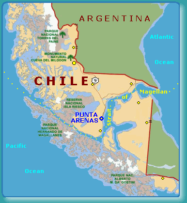
| ....................................................... A Voyage to Adak Alaska Via THE STRAIT OF MAGELLAN Strait of Magellan is a channel between the Atlantic and Pacific oceans. It separates the southern tip of the South American mainland from the island of Tierra del Fuego. The strait is about 530 km (about 330 mi) long and between 3 and 24 km (2 and 15 mi) wide. It was discovered by the Portuguese explorer Ferdinand Magellan in 1520. Go To Voyage Map |
 |
||
| Before the Panama Canal was completed, boats traveling between the U.S. coasts were forced to round the tip of South America. Many travelers risked disease and death by attempting to cross the dangerous isthmus in Central America and catch another boat to their destination to keep from sailing the extra 8000 miles. During the California Gold Rush in the mid-19th century there were many regular trips between the east coast and San Francisco. The Strait of Magellan lies just north of the southern tip of South America and is surrounded by Chile and Argentina. | |||
|
June 21, 2004
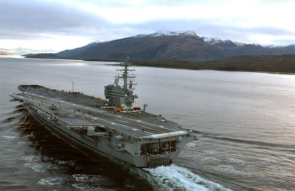
USS Ronald Reagan CVN-76
|
|
||
|
There are approximately 200 straits (narrow bodies of water connecting two larger bodies of water) or canals around the world but only a handful are known as chokepoints. A chokepoint is a strategic strait or canal which could be closed or blocked to stop sea traffic (especially oil). This type of aggression could surely cause an international incident. For centuries, straits such as Gibraltar
have been protected by
international law as points through which all nations may pass. In 1982
the Law of Sea Conventions further protected the international access
for nations to sail through straits and canals and even ensured that
these passageways are available as aviation routes for all nations.
From:
http://geography.about.com/library/weekly/aa052597.htm
|
|||


